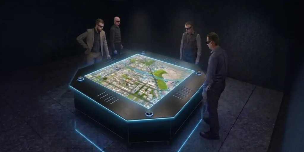
Holographic Digital Twin for Noida International Airport
An interactive 3D holographic simulation for large-scale infrastructure planning.

Project Overview
ViitorX engineered an interactive holographic digital twin of the Noida International Airport masterplan for YIAPL. We converted complex architectural data into a real-time, immersive 3D holographic experience rendered on a dedicated display table. This single, unified environment allowed stakeholders to navigate the airport infrastructure across multiple camera views, review specific construction phases, and interact directly with live data feeds.


Objective
The core objective was to replace conventional architectural presentations with an interactive holographic platform to clearly communicate the airport's full development scope. The primary goals included:
- Replacing static CAD-format presentations with a navigable, real-time 3D holographic model.
- Enabling direct design reviews and error identification within the digital environment.
- Visualizing multiple construction phases and post-completion milestones simultaneously.
- Presenting the masterplan to senior government dignitaries at the official ground-breaking ceremony.
Challenges
The airport's architectural data was large, complex, and difficult to communicate through standard presentation formats. The project team faced specific obstacles:
- Resource-intensive CAD files made real-time holographic rendering technically demanding without causing performance drops.
- Live construction timelines and phase progress data required on-demand synchronization into the model.
- Standard video walkthroughs and physical scale models failed to represent the full spatial and structural depth of the infrastructure.
Solutions
ViitorX designed and delivered an optimized 3D holographic model of the complete airport masterplan, including the surrounding area. The solution ran on Axiom Holographic hardware. Our direct actions included:
- Processing resource-heavy CAD and BIM data into lightweight polygon models suitable for high-fidelity holographic rendering.
- Implementing multi-view navigation via 3D glasses, allowing users to switch between first-person, bird's-eye, and cross-sectional perspectives.
- Integrating live construction data and phased milestones to provide stakeholders with on-demand progress updates.
- Equipping decision-makers with the necessary tools to identify spatial and structural errors invisible on 2D drawings.
- Demonstrating complex polygon models directly on the display table to merge design data with presentation.
Why NIA Chose ViitorX
NIA selected ViitorX for our technical capability in immersive holographic solutions and our ability to deliver on a precise timeline. Our proven experience processing large-scale CAD datasets and integrating real-time data feeds aligned directly with the project requirements.
ViitorX's innovative use of holographic technology to simulate Noida International Airport's (NIA) master plan provided us with a cutting-edge tool for detailed project visualization and planning.
- Chief Development Officer, NIA
Nicholas Schenk
Results & Impact
- Delivered 1 interactive holographic airport masterplan simulation.
- Presented live to 2 high-profile dignitaries, Prime Minister Narendra Modi and Chief Minister Yogi Adityanath, at the official ground-breaking ceremony.
- Replaced static presentations completely with a 360° interactive visualization.
- Provided decision-makers with real-time access to construction phase data across the timeline.
- Identified and flagged design errors prior to physical construction, reducing downstream correction risk.
- Enabled 3 distinct view modes for comprehensive spatial context of the masterplan.
Conclusion
ViitorX delivered a holographic digital twin that provided NIA decision-makers with direct, real-time access to their airport masterplan during a nationally significant milestone. The solution proved that interactive holographic technology serves as a practical, high-impact tool for large-scale infrastructure planning, clear stakeholder communication, and immediate design validation.