Government Tourism Immersive Centre: Preserving the Past with LiDAR and VR
A government tourism immersive centre provides a literal solution for managing high tourist traffic at fragile historical sites. Indian heritage sites face a direct conflict. The Ancient Monuments and Archaeological Sites and Remains (AMASR) Act strictly limits new construction near protected monuments.
Simultaneously, the Ministry of Tourism mandates an increase in global tourism footfall. State departments must accommodate thousands of daily visitors without physically altering or damaging ancient structures. Spatial technologies resolve this issue.
By utilizing Light Detection and Ranging (LiDAR) and Virtual Reality (VR), authorities build digital twins of these ruins. They construct the government tourism immersive centre outside the regulated physical zones. This approach diverts crowd pressure, preserves structural integrity, and delivers historical information accurately.
Why Does the AMASR Act Restrict Physical Tourism Expansion?
The AMASR Act categorizes land around protected monuments into specific zones to prevent structural decay from vibrations, pollution, and modern encroachment. The Archaeological Survey of India (ASI) monitors these boundaries strictly. State tourism boards cannot build modern visitor facilities, ticketing halls, or physical museums directly next to the ruins.
The table below outlines the specific restrictions enforced by the ASI around centrally protected monuments.
| Zone Type | Distance from Monument | Permitted Activities | Restricted Activities |
| Prohibited Area | 0 to 100 meters | Routine maintenance, essential ASI work | No new construction, no heavy machinery |
| Regulated Area | 100 to 200 meters | Minor repairs to existing structures | No large-scale commercial building, strict height limits |
To comply with these rules, authorities must physically locate any new government tourism immersive centre beyond the 200-meter mark. This spatial separation requires a robust digital connection to the site so visitors still receive an engaging historical experience.
How Do LiDAR Scanners Document Heritage Sites Accurately?
LiDAR scanners emit laser pulses to measure exact distances between the sensor and the physical ruin. The system records millions of data points to generate a millimeter-accurate 3D point cloud of the structure. This process requires zero physical contact with the fragile monument.
- Topographical mapping: LiDAR units mounted on drones capture the entire landscape, revealing buried structures without excavation.
- Structural analysis: Ground-based LiDAR detects microscopic cracks and structural shifts over time.
- Digital preservation: The 3D point clouds serve as permanent architectural records in case natural disasters damage the physical site.
Organizations utilize this geospatial data to monitor erosion. For instance, the Indian Space Research Organisation (ISRO) develops geospatial methodologies using LiDAR and satellite imagery for heritage documentation. Their data allows conservationists to track structural degradation accurately. The point cloud data also forms the foundational digital asset for any government tourism immersive centre. Developers convert the point cloud into optimized 3D meshes for interactive viewing.
What Are the Benefits of AR VR Heritage Site Interpretation?
Tourists expect detailed historical context when visiting monuments. Physical signboards often disrupt the visual aesthetics of the ruins and weather quickly. AR VR heritage site interpretation solves this problem by delivering information through digital devices.
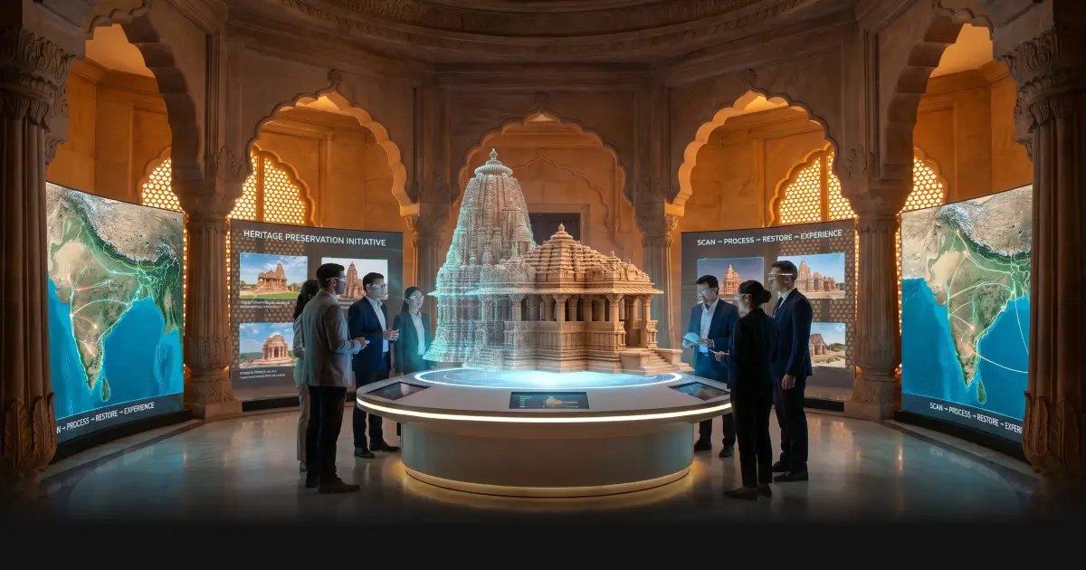
In a government tourism immersive centre, visitors use VR headsets to walk through fully restored digital models of the monument. They observe the original paint, intact statues, and complete roofs that no longer exist in reality. The VR environment isolates the user, focusing their attention entirely on the historical timeline.
At the physical site, AR VR heritage site interpretation operates via augmented reality on smartphones or dedicated tablets.
How Does AR VR Heritage Site Interpretation Function?
- Tourists point their device cameras at a ruined wall.
- The AR software identifies the wall structure using spatial tracking.
- The application superimposes a 3D reconstruction of the original wall onto the live camera feed.
- Users tap digital markers on their screens to read literal translations of ancient inscriptions.
State departments invest in to build these applications. This ensures tourists receive accurate educational content without requiring the installation of physical infrastructure near the monuments. A high-quality government tourism immersive centre relies entirely on this combination of on-site AR and off-site VR to manage visitor expectations.
Furthermore, AR VR heritage site interpretation allows museums to offer multilingual audio guides dynamically, adapting to the user’s selected language instantly. Proper AR VR heritage site interpretation scales easily, accommodating thousands of concurrent users through their personal mobile devices.
How Does Government Heritage VR Simulation Training Improve Staff Capacity?
Protecting ancient monuments requires highly trained personnel. The ASI and local tourism boards employ structural engineers, conservationists, and tour guides. Training these individuals on-site risks accidental damage to the fragile ruins. Government heritage VR simulation training provides a secure, digital environment for skill development.
Developers use the LiDAR data to program accurate physical physics and environmental conditions into a VR platform. Trainees wear VR headsets and use hand controllers to interact with the digital monument.
- Disaster response: Staff practice emergency evacuation procedures for large crowds during simulated earthquakes or fires.
- Conservation techniques: Archaeologists rehearse chemical cleaning methods on digital walls to observe simulated reactions before applying chemicals to real stone.
- Crowd management: Guides learn how to route large tour groups through narrow ancient corridors to prevent bottlenecks.
Government heritage VR simulation training reduces the cost of logistical transport for trainees. State departments centralize the education process within a dedicated government tourism immersive centre. This ensures all staff meet consistent operational standards. The Press Information Bureau (PIB) frequently details how government ministries adopt modern spatial technologies to upskill their workforce and standardize operations. Utilizing government heritage VR simulation training allows authorities to evaluate trainee performance through exact digital analytics. The system tracks where trainees look, how quickly they respond to hazards, and whether they follow correct conservation protocols.
Repeated use of government heritage VR simulation training ensures high readiness levels without degrading the physical heritage site. Therefore, integrating government heritage VR simulation training into departmental workflows is a direct requirement for modern monument administration.
How Can ViitorX Assist in Building Your Digital Experience?
State tourism boards require technically proficient partners to develop these spatial tech implementations. ViitorX builds robust digital platforms for cultural preservation and visitor engagement. We develop the software systems that power a government tourism immersive centre.
Our teams specialize in converting heavy LiDAR datasets into optimized 3D models suitable for real-time mobile and VR rendering. We integrate these models into interactive platforms. For example, our developers build virtual reality and mixed reality solutions that allow multiple users to collaborate inside a 3D environment simultaneously.
ViitorX configures Geo-Dataset-based immersive platforms. We process topographical data and load georeferenced 3D models into multi-user environments. This exact capability supports both public-facing virtual tours and internal administration systems. Furthermore, we develop AI-powered interactive displays. Our teams build interfaces where users draw shapes on digital screens to search for matching historical artifacts within a museum database.
We deliver complete digital experience services. We handle UX design, 3D environment creation, and application deployment. State authorities rely on ViitorX to deploy precise AR VR heritage site interpretation applications that function efficiently on standard consumer hardware. We also program specific operational scenarios for administrative use, ensuring accurate skill development across all departments.
Conclusion
A government tourism immersive centre allows state authorities to handle increasing visitor numbers while obeying the AMASR Act. By utilizing LiDAR, organizations capture exact structural data without physical contact. They use this data to create accurate digital twins. On-site, AR VR heritage site interpretation provides tourists with immediate historical context through their smartphones, eliminating the need for physical signage. Off-site, these digital twins form the core of virtual museums and interactive exhibits.
Concurrently, administrative departments deploy government heritage VR simulation training to prepare their staff for conservation and crowd management duties safely. These spatial technologies provide direct, measurable methods to balance heritage preservation with national tourism objectives. State departments must adopt these digital tools to maintain the structural integrity of India’s historical monuments.